Collections record Beta
Collection Record Detail
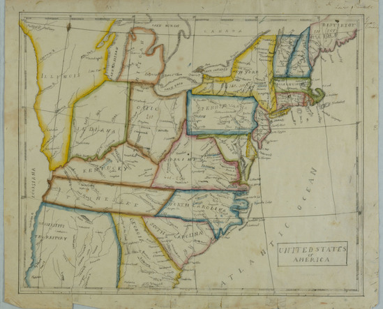
Object Name
Map of the United States
Object Number
1950-01-90b
Description
Map of the United States ca. 1825. Depicts the eastern side of the country. Lines of lattitude and longitude. States are outlined in various shapes of watercolor paint. Important cities and waterways labeled in ink.
Comment
Found among the papers of J. Deming Perkins, 1911, and given to Miss Quincy by M.W. Perkins, June 1911. Lucretia Deming attended the Litchfield Female Academy in 1816, 1818-1819.
Category
Date Made
1825
Dimensions
11 1/4" x 13 1/2"
Materials
Social Tags (experimental)